
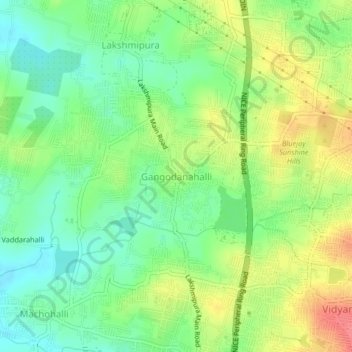
Gangodanahalli topographic map
Interactive map
Click on the map to display elevation.
About this map
Name: Gangodanahalli topographic map, elevation, terrain.
Average elevation: 865 m
Minimum elevation: 836 m
Maximum elevation: 906 m
Other topographic maps
Click on a map to view its topography, its elevation and its terrain.
Bengaluru
India > Karnataka > Bangalore North
Bengaluru (formerly Bangalore) is situated in the southeastern part of Karnataka, India, within the Bengaluru Urban district. It lies at an elevation of approximately 900 meters (3,000 feet) above sea level, on the Deccan Plateau. This elevated position gives the city a moderate climate, with temperatures…
Average elevation: 886 m