Gangnam-gu topographic map
Interactive map
Click on the map to display elevation.
About this map
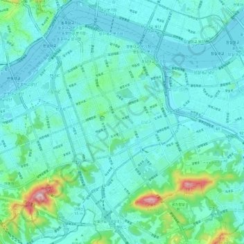
Name: Gangnam-gu topographic map, elevation, terrain.
Location: Gangnam-gu, Seoul, South Korea (37.45648 127.00838 37.53998 127.12273)
Average elevation: 44 m
Minimum elevation: 2 m
Maximum elevation: 284 m
Other topographic maps
Click on a map to view its topography, its elevation and its terrain.
Yongsan-gu
Yongsan is located next to the Han River, with level ground in the west of the district which has been used for transportation (rail) and commercial use since the early 20th century. To the east and north in the land is steeper and rises towards Namsan which lies to the north. Namsan has an elevation of 243m…
Average elevation: 39 m
Seodaemun-gu
Seodaemun District incorporates residential areas and historical areas including Bongwon Temple, Sinchon Railway Station (the oldest train station in Seoul) and Seodaemun Prison History Hall. Also it has a historic culture site "Seodaemun Independence Park." This place located at Dongnimmun station, includes a…
Average elevation: 70 m