
Thank you for supporting this site ❤️
Make a donation
Make a donation
Mayfouq topographic map
Click on the map to display elevation.
Thank you for supporting this site ❤️
Make a donation
Make a donation
About this map
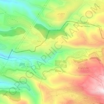
Name: Mayfouq topographic map, elevation, terrain.
Location: Mayfouq, Jbeil District, Keserwan-Jbeil Governorate, Lebanon (34.17258 35.74464 34.19569 35.79168)
Average elevation: 854 m
Minimum elevation: 550 m
Maximum elevation: 1,205 m
Thank you for supporting this site ❤️
Make a donation
Make a donation