
Palitana topographic map
Interactive map
Click on the map to display elevation.
About this map
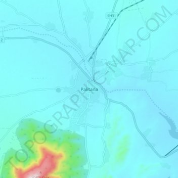
Name: Palitana topographic map, elevation, terrain.
Average elevation: 92 m
Minimum elevation: 46 m
Maximum elevation: 588 m
Palitana is located at 21°31′N 71°50′E / 21.52°N 71.83°E / 21.52; 71.83. It has an average elevation of 67 metres (219 feet). The Palitana dam, an irrigation resource, is on the Shetrunji River.
Other topographic maps
Click on a map to view its topography, its elevation and its terrain.
Shatrunjaya Hills
India > Gujarat > Palitana Taluka > Palitana
Shatrunjaya Hills, Palitana, Palitana Taluka, Bhavnagar District, Gujarat, 364270, India
Average elevation: 132 m