
Puncak Jaya topographic map
Interactive map
Click on the map to display elevation.
About this map
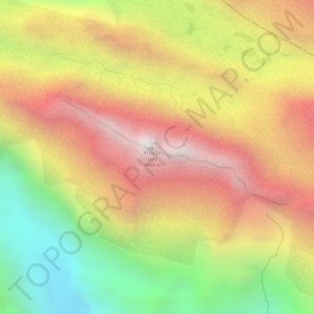
Name: Puncak Jaya topographic map, elevation, terrain.
Location: Puncak Jaya, Mimika, Papua, Indonesia (-4.07865 137.15856 -4.07855 137.15866)
Average elevation: 4,271 m
Minimum elevation: 3,580 m
Maximum elevation: 4,819 m
Puncak Jaya (Indonesian: ; literally "Glorious Peak") or Carstensz Pyramid, Mount Jayawijaya or Mount Carstensz (/ˈkɑːrstəns/) on the island of New Guinea, with an elevation of 4,884 m (16,024 ft), is the highest mountain peak of an island on Earth. The mountain is located in the Sudirman Range of the western central highlands of Papua Province, Indonesia, in the southwest of Puncak Jaya Regency.