
Spital am Pyhrn topographic map
Interactive map
Click on the map to display elevation.
About this map
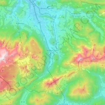
Name: Spital am Pyhrn topographic map, elevation, terrain.
Average elevation: 1,106 m
Minimum elevation: 571 m
Maximum elevation: 2,367 m
Other topographic maps
Click on a map to view its topography, its elevation and its terrain.
Vorderstoder
Oostenrijk > Opper-Oostenrijk > Bezirk Kirchdorf
Vorderstoder, Bezirk Kirchdorf, Opper-Oostenrijk, 4574, Oostenrijk
Average elevation: 1,134 m