
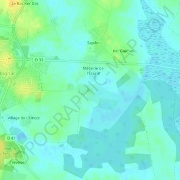
Château de Ranrouët topographic map
Interactive map
Click on the map to display elevation.
About this map
Name: Château de Ranrouët topographic map, elevation, terrain.
Average elevation: 7 m
Minimum elevation: -2 m
Maximum elevation: 23 m
Other topographic maps
Click on a map to view its topography, its elevation and its terrain.
Le Haillot
France > Pays de la Loire > Herbignac > Le Haillot
Le Haillot, Herbignac, Saint-Nazaire, Loire-Atlantique, Pays de la Loire, France métropolitaine, 44410, France
Average elevation: 29 m
Étang du pré Grasseur
France > Pays de la Loire > Herbignac
Étang du pré Grasseur, Rue du Pré Grasseur, Le Grand, Herbignac, Saint-Nazaire, Loire-Atlantique, Pays de la Loire, France métropolitaine, 44410, France
Average elevation: 16 m