
Cervo topographic map
Interactive map
Click on the map to display elevation.
About this map
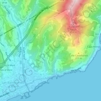
Name: Cervo topographic map, elevation, terrain.
Location: Cervo, Provincia di Imperia, Ligurië, Italië (43.92080 8.10475 43.94318 8.13540)
Average elevation: 87 m
Minimum elevation: 0 m
Maximum elevation: 357 m
Other topographic maps
Click on a map to view its topography, its elevation and its terrain.
Langhe
Italië > Ligurië > Provincia di Imperia > Mendatica
Langhe, Mendatica, Provincia di Imperia, Ligurië, 18025, Italië
Average elevation: 1,330 m