
Wambrook topographic map
Interactive map
Click on the map to display elevation.
About this map
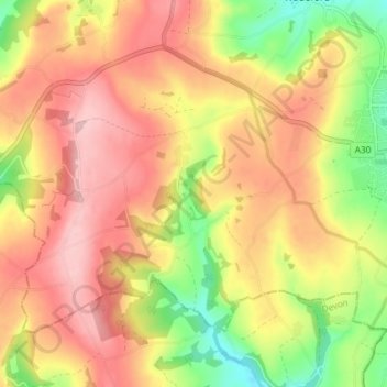
Name: Wambrook topographic map, elevation, terrain.
Location: Wambrook, South Somerset, Somerset, England, United Kingdom (50.85094 -3.04612 50.88407 -2.97309)
Average elevation: 184 m
Minimum elevation: 93 m
Maximum elevation: 251 m