
Traill topographic map
Interactive map
Click on the map to display elevation.
About this map
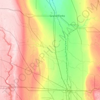
Name: Traill topographic map, elevation, terrain.
Location: Traill, Traill County, Dakota du Nord, États-Unis d'Amérique (46.74385 -97.87970 48.14385 -96.47970)
Average elevation: 331 m
Minimum elevation: 245 m
Maximum elevation: 481 m
Other topographic maps
Click on a map to view its topography, its elevation and its terrain.
Schmidt
États-Unis d'Amérique > Dakota du Nord > Schmidt
Schmidt, Morton County, Dakota du Nord, États-Unis d'Amérique
Average elevation: 529 m