
Beaver topographic map
Interactive map
Click on the map to display elevation.
About this map
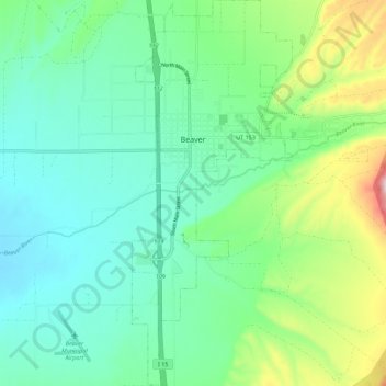
Name: Beaver topographic map, elevation, terrain.
Location: Beaver, Beaver County, Utah, 84713, USA (38.22041 -112.66295 38.30820 -112.61087)
Average elevation: 1,830 m
Minimum elevation: 1,735 m
Maximum elevation: 2,106 m