
Basel topographic map
Interactive map
Click on the map to display elevation.
About this map
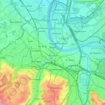
Name: Basel topographic map, elevation, terrain.
Location: Basel, Basel-Stadt, Schweiz (47.51929 7.55466 47.58990 7.63414)
Average elevation: 285 m
Minimum elevation: 243 m
Maximum elevation: 396 m
Other topographic maps
Click on a map to view its topography, its elevation and its terrain.