
Cigla topographic map
Interactive map
Click on the map to display elevation.
About this map
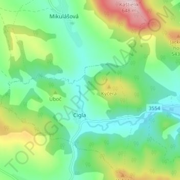
Name: Cigla topographic map, elevation, terrain.
Location: Cigla, Region of Prešov, Eastern Slovakia, 086 37, Slovakia (49.34667 21.38000 49.38667 21.42000)
Average elevation: 409 m
Minimum elevation: 305 m
Maximum elevation: 638 m