
Auersberg topographic map
Interactive map
Click on the map to display elevation.
About this map
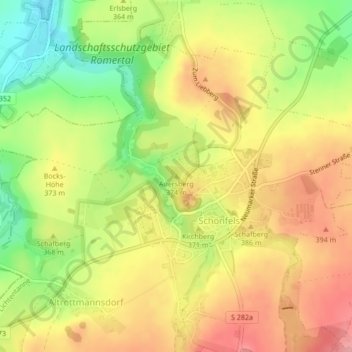
Name: Auersberg topographic map, elevation, terrain.
Location: Auersberg, Lichtentanne, Zwickau, Sachsen, 08115, Deutschland (50.67762 12.39937 50.67772 12.39947)
Average elevation: 363 m
Minimum elevation: 304 m
Maximum elevation: 411 m
Other topographic maps
Click on a map to view its topography, its elevation and its terrain.
Ebersbrunn
Deutschland > Sachsen > Lichtentanne
Ebersbrunn, Lichtentanne, Zwickau, Sachsen, Deutschland
Average elevation: 428 m