
Thank you for supporting this site ❤️
Make a donation
Make a donation
Shellharbour City Council topographic map
Click on the map to display elevation.
Thank you for supporting this site ❤️
Make a donation
Make a donation
About this map
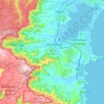
Name: Shellharbour City Council topographic map, elevation, terrain.
Location: Shellharbour City Council, New South Wales, Australia (-34.64324 150.63792 -34.52985 150.90452)
Average elevation: 198 m
Minimum elevation: -2 m
Maximum elevation: 769 m
Thank you for supporting this site ❤️
Make a donation
Make a donation
Other topographic maps
Click on a map to view its topography, its elevation and its terrain.
Thank you for supporting this site ❤️
Make a donation
Make a donation
Thank you for supporting this site ❤️
Make a donation
Make a donation
Thank you for supporting this site ❤️
Make a donation
Make a donation