
Einde Gooi topographic map
Interactive map
Click on the map to display elevation.
About this map
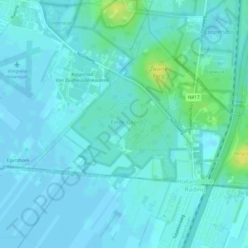
Name: Einde Gooi topographic map, elevation, terrain.
Average elevation: 4 m
Minimum elevation: -2 m
Maximum elevation: 19 m
Other topographic maps
Click on a map to view its topography, its elevation and its terrain.
Hilversumse Meent
Nederland > Noord-Holland > Hilversum
Hilversumse Meent, Hilversum, Noord-Holland, Nederland
Average elevation: 2 m
Spanderswoud
Nederland > Noord-Holland > Hilversum
Spanderswoud, Hilversum, Noord-Holland, Nederland
Average elevation: 5 m
Zanderij Crailoo
Nederland > Noord-Holland > Hilversum
Zanderij Crailoo, Hilversum, Noord-Holland, Nederland, 1217 DZ, Nederland
Average elevation: 7 m