
Haixi Mongol and Tibetan Autonomous Prefecture topographic map
Interactive map
Click on the map to display elevation.
About this map
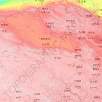
Name: Haixi Mongol and Tibetan Autonomous Prefecture topographic map, elevation, terrain.
Location: Haixi Mongol and Tibetan Autonomous Prefecture, Qinghai, China (33.86662 90.10776 39.21423 99.69190)
Average elevation: 3,739 m
Minimum elevation: 788 m
Maximum elevation: 6,676 m
Other topographic maps
Click on a map to view its topography, its elevation and its terrain.