
Santa Rosa (Los Gonzalez) topographic map
Interactive map
Click on the map to display elevation.
About this map
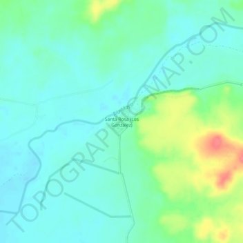
Name: Santa Rosa (Los Gonzalez) topographic map, elevation, terrain.
Location: Santa Rosa (Los Gonzalez), Navojoa, Sonora, México (27.20795 -109.35294 27.24795 -109.31294)
Average elevation: 66 m
Minimum elevation: 49 m
Maximum elevation: 114 m
Other topographic maps
Click on a map to view its topography, its elevation and its terrain.