
Greenhills topographic map
Interactive map
Click on the map to display elevation.
About this map
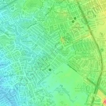
Name: Greenhills topographic map, elevation, terrain.
Average elevation: 32 m
Minimum elevation: 8 m
Maximum elevation: 77 m
Greenhills and the adjacent West Crame are the only barangays in San Juan that are not entirely situated on tuff and tuffaceous sedimentary rock, with parts of the barangay being situated on top of pyroclastic flow adobe deposits. The highest elevation of San Juan can be found in Greenhills at its border with Quezon City's Barangay Camp Aguinaldo along EDSA, peaking at 34 meters (112 ft) above sea level.