
Étang de Carcraon topographic map
Interactive map
Click on the map to display elevation.
About this map
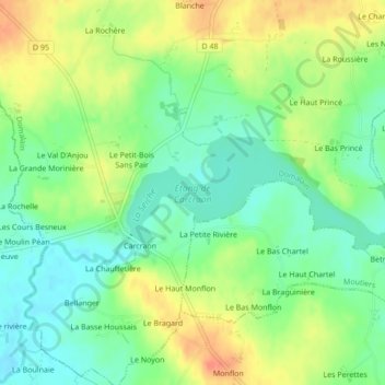
Name: Étang de Carcraon topographic map, elevation, terrain.
Average elevation: 66 m
Minimum elevation: 46 m
Maximum elevation: 91 m
Other topographic maps
Click on a map to view its topography, its elevation and its terrain.
La Barre Lotton
France > Bretagne > Domalain > La Barre Lotton
La Barre Lotton, Domalain, Fougères-Vitré, Ille-et-Vilaine, Bretagne, France métropolitaine, 35680, France
Average elevation: 78 m