
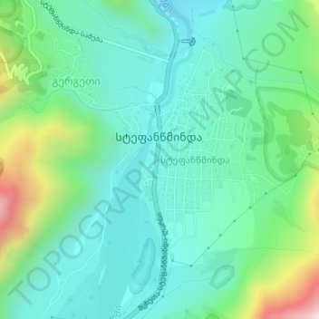
Stephantsminda topographic map
Interactive map
Click on the map to display elevation.
About this map
Name: Stephantsminda topographic map, elevation, terrain.
Average elevation: 1,854 m
Minimum elevation: 1,678 m
Maximum elevation: 2,397 m
La ville est établie dans une vallée d'un affluent du cours supérieur du fleuve Terek, à une altitude de 1 740 m, aux pieds des montagnes ː Mont Kazbek et Mont Chani.