
Thank you for supporting this site ❤️
Make a donation
Make a donation
Wai topographic map
Click on the map to display elevation.
Thank you for supporting this site ❤️
Make a donation
Make a donation
Wai
Wai is located at 17°56′N 73°53′E / 17.94°N 73.88°E / 17.94; 73.88, approximately 35 km (22 mi) north of the city of Satara. It has an average elevation of 718 metres (2,356 ft). It is surrounded by the mountainous region of the Sahyādris.
Thank you for supporting this site ❤️
Make a donation
Make a donation
About this map
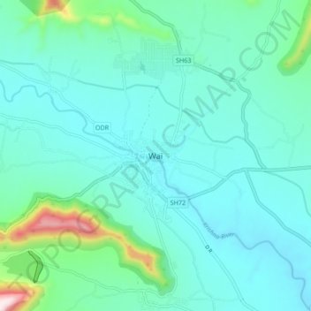
Name: Wai topographic map, elevation, terrain.
Location: Wai, Satara, Maharashtra, 412803, India (17.91199 73.85130 17.99199 73.93130)
Average elevation: 762 m
Minimum elevation: 678 m
Maximum elevation: 1,209 m
Thank you for supporting this site ❤️
Make a donation
Make a donation
Other topographic maps
Click on a map to view its topography, its elevation and its terrain.