
Chóchope topographic map
Interactive map
Click on the map to display elevation.
About this map
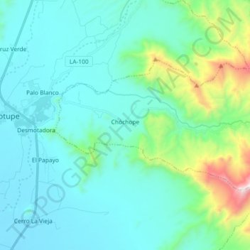
Name: Chóchope topographic map, elevation, terrain.
Location: Chóchope, Lambayeque, Perú (-6.19700 -79.68874 -6.12232 -79.54466)
Average elevation: 351 m
Minimum elevation: 103 m
Maximum elevation: 1,620 m