
Podčetrtek topographic map
Interactive map
Click on the map to display elevation.
About this map
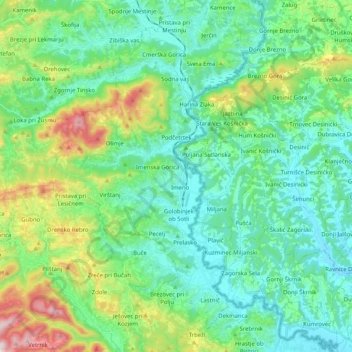
Name: Podčetrtek topographic map, elevation, terrain.
Location: Podčetrtek, Slovenië (46.06546 15.52482 46.20688 15.63827)
Average elevation: 301 m
Minimum elevation: 165 m
Maximum elevation: 732 m