
Rio Paniola topographic map
Interactive map
Click on the map to display elevation.
About this map
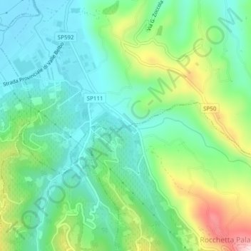
Name: Rio Paniola topographic map, elevation, terrain.
Location: Rio Paniola, San Vito, Calamandrana, Asti, Piemont, 14042, Italy (44.71896 8.33009 44.71902 8.33009)
Average elevation: 234 m
Minimum elevation: 143 m
Maximum elevation: 446 m