
Thank you for supporting this site ❤️
Make a donation
Make a donation
Le Colombier topographic map
Click on the map to display elevation.
Thank you for supporting this site ❤️
Make a donation
Make a donation
About this map
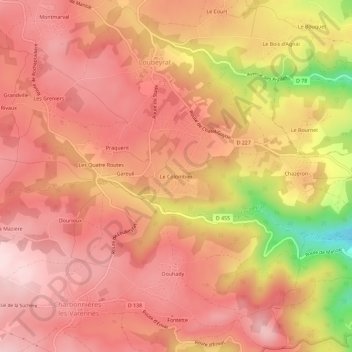
Name: Le Colombier topographic map, elevation, terrain.
Average elevation: 681 m
Minimum elevation: 469 m
Maximum elevation: 772 m
Thank you for supporting this site ❤️
Make a donation
Make a donation
Other topographic maps
Click on a map to view its topography, its elevation and its terrain.
Château de Chazeron
France > Auvergne-Rhône-Alpes > Puy-de-Dôme > Loubeyrat > Chazeron
Average elevation: 604 m