
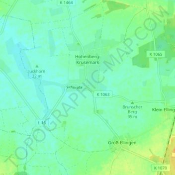
Hohenberg-Krusemark topographic map
Interactive map
Click on the map to display elevation.
About this map
Name: Hohenberg-Krusemark topographic map, elevation, terrain.
Average elevation: 34 m
Minimum elevation: 26 m
Maximum elevation: 50 m
Aland | Altmärkische Höhe | Altmärkische Wische | Eichstedt (Altmark) | Goldbeck | Hassel | Hohenberg-Krusemark | Iden | Kamern | Klietz | Rochau | Schollene | Schönhausen (Elbe) | Wust-Fischbeck | Zehrental
Other topographic maps
Click on a map to view its topography, its elevation and its terrain.
Hohenberg-Krusemark
Deutschland > Sachsen-Anhalt > Stendal > Hohenberg-Krusemark
Hohenberg-Krusemark, Arneburg-Goldbeck, Stendal, Sachsen-Anhalt, Deutschland
Average elevation: 35 m