
Уæллаг Къоркъула topographic map
Interactive map
Click on the map to display elevation.
About this map
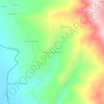
Name: Уæллаг Къоркъула topographic map, elevation, terrain.
Location: Уæллаг Къоркъула, Цхинвалы район, Ossétie du Sud, Géorgie (42.19167 44.10422 42.23167 44.14422)
Average elevation: 1,135 m
Minimum elevation: 853 m
Maximum elevation: 1,606 m