
Tail topographic map
Interactive map
Click on the map to display elevation.
About this map
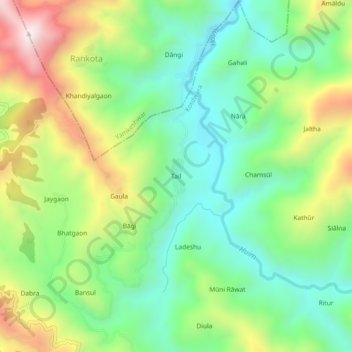
Name: Tail topographic map, elevation, terrain.
Location: Tail, Kotdwara, Pauri Garhwal, Uttarakhand, 246144, Índia (29.88754 78.48959 29.92754 78.52959)
Average elevation: 1,105 m
Minimum elevation: 837 m
Maximum elevation: 1,571 m