
Thank you for supporting this site ❤️
Make a donation
Make a donation
Shirodi topographic map
Click on the map to display elevation.
Thank you for supporting this site ❤️
Make a donation
Make a donation
About this map
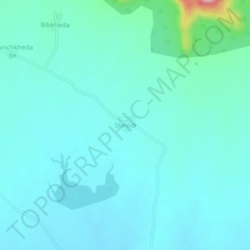
Name: Shirodi topographic map, elevation, terrain.
Location: Shirodi, Kannad, Aurangabad, Maharashtra, India (20.17676 74.97560 20.21676 75.01560)
Average elevation: 617 m
Minimum elevation: 585 m
Maximum elevation: 822 m
Thank you for supporting this site ❤️
Make a donation
Make a donation
Other topographic maps
Click on a map to view its topography, its elevation and its terrain.