

Make a donation
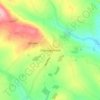
Buttevant topographic map
Click on the map to display elevation.
Make a donation
Buttevant
The development of the settlement followed a pattern frequently repeated in the Norman colonies of North Cork and Limerick. The original nucleus of the town consisted of a keep situated on an elevation on the south side of the town. Opposite the keep, on a pre-Norman site, was built the parish church, dedicated to St. Brigit, sister of St. Colman of Cloyne. A mill, another characteristic element of Norman settlements, was located on the river, to the north of the keep. In addition, a hospice for lepers was established about a mile to the North East outside of the town wall. This basic structure was repeated in nearby Castletownroche, where it is still clearly to be seen, in Glanworth, Mallow, and in Kilmallock and Adare.
Make a donation
About this map

Name: Buttevant topographic map, elevation, terrain.
Average elevation: 93 m
Minimum elevation: 75 m
Maximum elevation: 130 m
Make a donation
Other topographic maps
Click on a map to view its topography, its elevation and its terrain.


Make a donation


Make a donation
Make a donation
Make a donation


Make a donation

Make a donation


Make a donation

Make a donation

Make a donation

Make a donation
Make a donation



Make a donation

Make a donation


Make a donation
Make a donation

Make a donation
Watergrasshill
According to A Topographical Dictionary of Ireland, published by Samuel Lewis in 1837, Watergrasshill then had a population of 533 people.
Average elevation: 164 m


Make a donation


Make a donation


Make a donation


Make a donation


Make a donation


Make a donation

Make a donation

Make a donation
Make a donation