
Terni topographic map
Interactive map
Click on the map to display elevation.
About this map
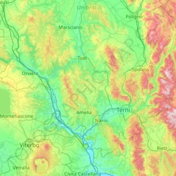
Name: Terni topographic map, elevation, terrain.
Location: Terni, Umbria, Italy (42.36478 11.89203 42.94313 12.89620)
Average elevation: 425 m
Minimum elevation: 31 m
Maximum elevation: 1,756 m
Other topographic maps
Click on a map to view its topography, its elevation and its terrain.
Castiglione del Lago
Italy > Umbria > Castiglione del Lago
Castiglione del Lago, PG, Umbria, 06061, Italy
Average elevation: 285 m