
Dotnacht topographic map
Interactive map
Click on the map to display elevation.
About this map
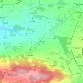
Name: Dotnacht topographic map, elevation, terrain.
Location: Dotnacht, Bezirk Kreuzlingen, Thurgau, 8566, Schweiz (47.57980 9.12128 47.61980 9.16128)
Average elevation: 555 m
Minimum elevation: 470 m
Maximum elevation: 693 m