
دریاچه ارومیه topographic map
Interactive map
Click on the map to display elevation.
About this map
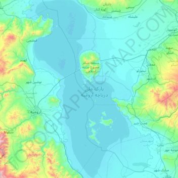
Name: دریاچه ارومیه topographic map, elevation, terrain.
Location: دریاچه ارومیه, استان آذربایجان غربی, Irã (37.13310 45.05151 38.24207 45.80759)
Average elevation: 1,444 m
Minimum elevation: 1,264 m
Maximum elevation: 3,423 m