
Thank you for supporting this site ❤️
Make a donation
Make a donation
Hawarden topographic map
Click on the map to display elevation.
Thank you for supporting this site ❤️
Make a donation
Make a donation
About this map
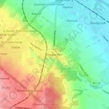
Name: Hawarden topographic map, elevation, terrain.
Location: Hawarden, Flintshire, Wales, CH5 3DH, United Kingdom (53.16478 -3.04666 53.20478 -3.00666)
Average elevation: 57 m
Minimum elevation: 3 m
Maximum elevation: 140 m
Thank you for supporting this site ❤️
Make a donation
Make a donation
Other topographic maps
Click on a map to view its topography, its elevation and its terrain.