
Choondal topographic map
Interactive map
Click on the map to display elevation.
About this map
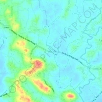
Name: Choondal topographic map, elevation, terrain.
Location: Choondal, Kunnamkulam, Thrissur, Kerala, 680502, India (10.60566 76.07986 10.64566 76.11986)
Average elevation: 12 m
Minimum elevation: -2 m
Maximum elevation: 53 m
Other topographic maps
Click on a map to view its topography, its elevation and its terrain.