
Belen topographic map
Interactive map
Click on the map to display elevation.
About this map
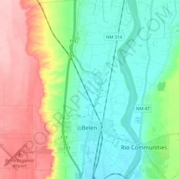
Name: Belen topographic map, elevation, terrain.
Average elevation: 1,508 m
Minimum elevation: 1,460 m
Maximum elevation: 1,605 m
Other topographic maps
Click on a map to view its topography, its elevation and its terrain.
Suwanee
Vereinigte Staaten von Amerika > Neumexiko > Valencia County > Suwanee
Suwanee, Valencia County, Neumexiko, 87026, Vereinigte Staaten von Amerika
Average elevation: 1,675 m