
Quinten topographic map
Interactive map
Click on the map to display elevation.
About this map
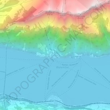
Name: Quinten topographic map, elevation, terrain.
Location: Quinten, Wahlkreis Sarganserland, Sankt Gallen, 8878, Schweiz (47.11002 9.19622 47.15002 9.23622)
Average elevation: 848 m
Minimum elevation: 418 m
Maximum elevation: 2,170 m