
Thank you for supporting this site ❤️
Make a donation
Make a donation
Neck City topographic map
Click on the map to display elevation.
Thank you for supporting this site ❤️
Make a donation
Make a donation
About this map
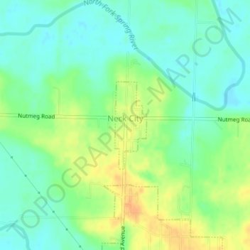
Name: Neck City topographic map, elevation, terrain.
Location: Neck City, Jasper County, Missouri, 64849, United States (37.25149 -94.44583 37.26094 -94.44149)
Average elevation: 279 m
Minimum elevation: 266 m
Maximum elevation: 298 m
Thank you for supporting this site ❤️
Make a donation
Make a donation
Other topographic maps
Click on a map to view its topography, its elevation and its terrain.