
Le Rosex topographic map
Interactive map
Click on the map to display elevation.
About this map
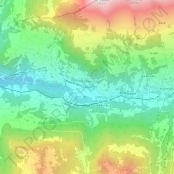
Name: Le Rosex topographic map, elevation, terrain.
Location: Le Rosex, Ormont-Dessus, District d'Aigle, Waadt, 1864, Schweiz (46.33647 7.08789 46.37647 7.12789)
Average elevation: 1,464 m
Minimum elevation: 985 m
Maximum elevation: 2,268 m