
Thank you for supporting this site ❤️
Make a donation
Make a donation
nachipalayam topographic map
Click on the map to display elevation.
Thank you for supporting this site ❤️
Make a donation
Make a donation
About this map
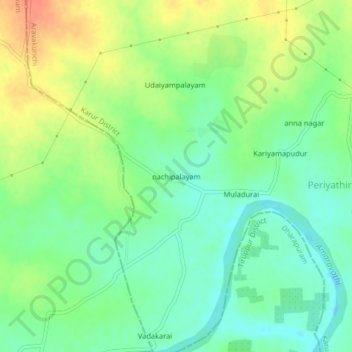
Name: nachipalayam topographic map, elevation, terrain.
Location: nachipalayam, Aravakurichi, Karur District, Tamil Nadu, India (10.87054 77.75795 10.91054 77.79795)
Average elevation: 192 m
Minimum elevation: 173 m
Maximum elevation: 219 m
Thank you for supporting this site ❤️
Make a donation
Make a donation
Other topographic maps
Click on a map to view its topography, its elevation and its terrain.