
Parc national de Mammoth Cave topographic map
Interactive map
Click on the map to display elevation.
About this map
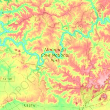
Name: Parc national de Mammoth Cave topographic map, elevation, terrain.
Average elevation: 215 m
Minimum elevation: 132 m
Maximum elevation: 300 m
Other topographic maps
Click on a map to view its topography, its elevation and its terrain.
Mammoth Cave
États-Unis d'Amérique > Kentucky > Mammoth Cave
Mammoth Cave, Edmonson County, Kentucky, États-Unis d'Amérique
Average elevation: 214 m