
Thank you for supporting this site ❤️
Make a donation
Make a donation
Rosenheim topographic map
Click on the map to display elevation.
Thank you for supporting this site ❤️
Make a donation
Make a donation
About this map
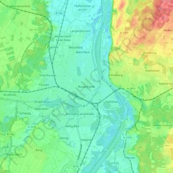
Name: Rosenheim topographic map, elevation, terrain.
Location: Rosenheim, Bayern, Oberbayern, Bayern, 83022, Deutschland (47.81393 12.08726 47.89393 12.16726)
Average elevation: 464 m
Minimum elevation: 435 m
Maximum elevation: 531 m
Thank you for supporting this site ❤️
Make a donation
Make a donation
Other topographic maps
Click on a map to view its topography, its elevation and its terrain.