
Matterhorn topographic map
Interactive map
Click on the map to display elevation.
About this map
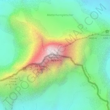
Name: Matterhorn topographic map, elevation, terrain.
Location: Matterhorn, Valtournenche, Valle d'Aosta, Italië (45.97639 7.65852 45.97649 7.65862)
Average elevation: 3,295 m
Minimum elevation: 2,762 m
Maximum elevation: 4,389 m
De Matterhorn (Italiaans: Cervino; Frans: Cervin) is een berg gelegen in de Walliser Alpen, op de grens van Zwitserland (Wallis) en Italië (Valle d'Aosta). De top ligt op 4478 m hoogte. De foto rechts is genomen ten noordoosten van de Matterhorn, vanuit Zermatt aan het eind van het Mattertal in Zwitserland. Deze kant van de berg is het bekendst: het is een symbool voor Zwitserland geworden. Aan de Italiaanse kant ligt het eveneens toeristische Breuil-Cervinia.