
06636 topographic map
Interactive map
Click on the map to display elevation.
About this map
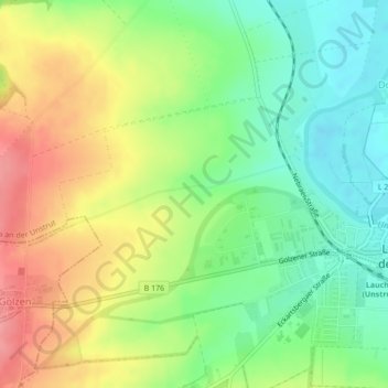
Name: 06636 topographic map, elevation, terrain.
Average elevation: 146 m
Minimum elevation: 105 m
Maximum elevation: 198 m
Other topographic maps
Click on a map to view its topography, its elevation and its terrain.
Dorndorf
Deutschland > Sachsen-Anhalt > Burgenlandkreis > Laucha an der Unstrut
Dorndorf, Laucha an der Unstrut, Unstruttal, Burgenlandkreis, Sachsen-Anhalt, 06636, Deutschland
Average elevation: 150 m