
Thank you for supporting this site ❤️
Make a donation
Make a donation
Campbell County topographic map
Click on the map to display elevation.
Thank you for supporting this site ❤️
Make a donation
Make a donation
About this map
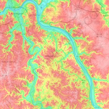
Name: Campbell County topographic map, elevation, terrain.
Location: Campbell County, Kentucky, United States (38.80579 -84.50612 39.12194 -84.23197)
Average elevation: 223 m
Minimum elevation: 140 m
Maximum elevation: 290 m
Thank you for supporting this site ❤️
Make a donation
Make a donation
Other topographic maps
Click on a map to view its topography, its elevation and its terrain.