
Napara topographic map
Interactive map
Click on the map to display elevation.
About this map
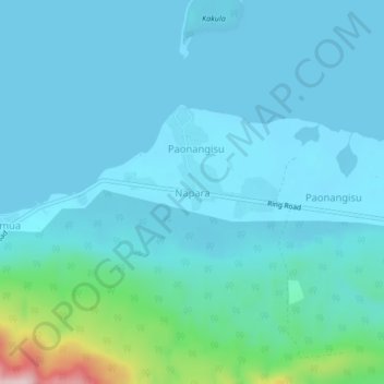
Name: Napara topographic map, elevation, terrain.
Location: Napara, Shefa Province, Vanuatu (-17.55572 168.38333 -17.51572 168.42333)
Average elevation: 46 m
Minimum elevation: 0 m
Maximum elevation: 388 m
Other topographic maps
Click on a map to view its topography, its elevation and its terrain.
Port Vila
Vanuatu > Shefa Province > Port Vila
Port Vila, Shefa Province, PMB 9054, Vanuatu
Average elevation: 82 m