
Miscou Harbour topographic map
Interactive map
Click on the map to display elevation.
About this map
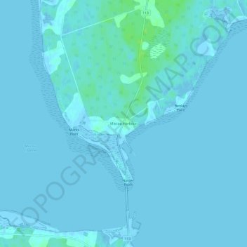
Name: Miscou Harbour topographic map, elevation, terrain.
Average elevation: 1 m
Minimum elevation: -3 m
Maximum elevation: 9 m
Other topographic maps
Click on a map to view its topography, its elevation and its terrain.
Shippagan
Canada > New Brunswick > Shippagan Parish
Shippagan, Shippagan Parish, Gloucester County, New Brunswick, Canada
Average elevation: 2 m
Fox Dens Gully
Canada > New Brunswick > Shippagan Parish
Fox Dens Gully, Shippagan Parish, Gloucester County, New Brunswick, Canada
Average elevation: 0 m
Lamèque
Canada > New Brunswick > Shippagan Parish
Lamèque, Shippagan Parish, Gloucester County, New Brunswick, E8T 1M6, Canada
Average elevation: 5 m