
Thank you for supporting this site ❤️
Make a donation
Make a donation
Martinez topographic map
Click on the map to display elevation.
Thank you for supporting this site ❤️
Make a donation
Make a donation
About this map
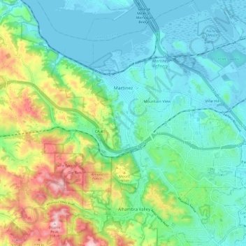
Name: Martinez topographic map, elevation, terrain.
Location: Martinez, Contra Costa County, California, United States (37.95356 -122.15717 38.04739 -122.07517)
Average elevation: 95 m
Minimum elevation: -3 m
Maximum elevation: 356 m
Thank you for supporting this site ❤️
Make a donation
Make a donation
Other topographic maps
Click on a map to view its topography, its elevation and its terrain.