
Pati topographic map
Interactive map
Click on the map to display elevation.
About this map
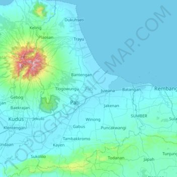
Name: Pati topographic map, elevation, terrain.
Location: Pati, Java Central, Indonesia (-7.00367 110.80324 -6.41022 111.27089)
Average elevation: 101 m
Minimum elevation: 0 m
Maximum elevation: 1,561 m
Other topographic maps
Click on a map to view its topography, its elevation and its terrain.
Purwokerto
Indonesia > Java Central > Purwokerto
Purwokerto, Banyumas, Java Central, 53116, Indonesia
Average elevation: 277 m